
Search Pleasants County Property Records
No single system answers every question about land in Pleasants County. Each office keeps its own piece. An address, owner name, or parcel clue gets you started, and the county assessment card usually pins down the parcel number from there. That number can lead to a deed book and page, and the Pleasants County Clerk index then shows the recorded instrument itself. Tax bills, parcel maps, and city permits each add facts the others lack. Results work best when you check one against the next, because a mailing address, an appraisal value, a map line, and a recorded deed do not all mean the same thing.
The same county route covers property in St. Marys and Belmont. Pleasants County holds the land records for both incorporated places. City offices add permits, ordinances, utilities, and street context on top of that. A property search can show what the public systems contain, but a legal decision still calls for a recorded deed, a survey, or a certified court record.
- Search the WV Property Viewer by address; try a street variant if no parcel appears.
- Open the assessment detail and note Owner(s), PID, legal description, and Book/Page.
- Use the Pleasants County Clerk IDX to check the deed and related land instruments.
- Use Sheriff Tax Inquiry for billed, paid, and due amounts, then use MapWV for map context.
- Contact the record custodian for copies, older volumes, or a result that needs certification.
Pleasants County Property Records: Assessor Search Links
The Pleasants Assessor page gathers county tax maps, scanned map cards, land books, personal-property forms, Tax Inquiry, the County Clerk index, MapWV, and state tax resources. It also links to WVGenWeb. Treat these as separate record paths rather than a single property report. When an address result comes up thin, the scanned map card may tie a parcel key to an older lot description. The land book can do the same.
The Pleasants County Assessor home page lists the public property and tax resources.
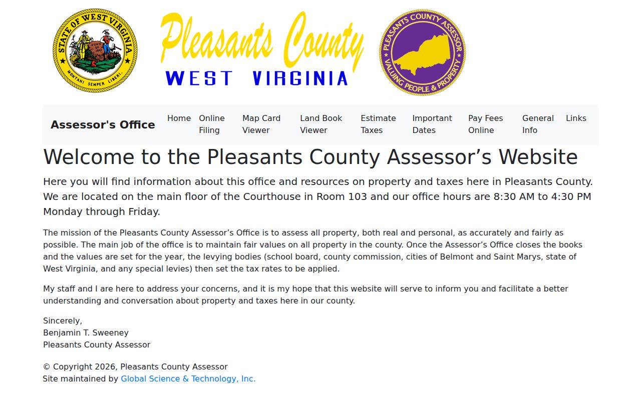
Begin with the official resource list, then move to the office system that holds the deed, assessment, tax account, or map you need.
The Offices Behind Pleasants County Property Records
Three offices divide the work behind Pleasants County property records. The County Clerk records deeds and other county instruments. The Assessor maintains the real estate books, assessment cards, and tax maps. The Sheriff, as county treasurer, collects the property taxes. The WV Property Viewer links a parcel to its assessment detail, though it remains a state map and assessment service rather than the Clerk's deed book. County offices sit at 301 Court Lane in St. Marys, except the Sheriff/Tax Office, which lists 305 Barkwill Street.
Pleasants County general office hours run Monday through Friday, 8:30 a.m. to 4:30 p.m.; the Sheriff lists 8:00 a.m. to 4:00 p.m. Ask about a specific file, appointment, or copy before traveling. The Assessor links tax inquiry, deed inquiry, MapWV, the state Tax Department, and WVGenWeb from one resource page, so it makes a good starting point when the right portal is unclear.
Four Record Types in Pleasants County Property Records
A Pleasants County property search never returns one tidy report. A deed documents a transfer. The assessment card names the owner on the tax roll. It lists parcel and value fields. The Sheriff account tracks tax charges, and the tax map shows the parcel drawn. Each record has a keeper and a limit. Rely on the County Clerk for the instrument. The Assessor handles assessment and map-card facts. The Sheriff handles payment status.
| Record | What It Can Show | Custodian | Access Route |
|---|---|---|---|
| Deed, plat, lien, release | Parties, date, instrument, book/page, legal description | Pleasants County Clerk | IDX index, office, or written request |
| Assessment card and land book | Owner(s), PID, addresses, acres, class/use, appraised values | Pleasants County Assessor | MapWV, scanned card/book, or counter |
| Tax account | Year, ticket, billed, paid, half-payment, due, billing address | Sheriff / Tax Office | Tax inquiry or office |
| Parcel map or plat | District, map, parcel, lot lines, roads, and corporation lines | Assessor / WV GIS | MapWV or the official PDF map archive |
| Municipal permit or ordinance | City work and approvals, where the city holds a file | St. Marys or Belmont | Ask the city; no searchable permit fields were captured |
Pleasants County records work best as a linked trail. Search the deed index when the question involves a transfer or a recorded burden. Turn to tax records for an amount or a due date. A recorded deed is not a tax receipt. The map is not a deed.
Parcel IDs in Pleasants County Property Records
The WV Property Viewer uses a county, district, map, parcel, and suffix pattern. A captured Pleasants County example is 37-06-0001-0096-0000: county 37, St. Marys corporation district 06, map 0001, parcel 0096, suffix 0000. The assessment page also gives a 20-digit root PID. These parts help distinguish similar street addresses and connect a map result with an assessment card or deed reference.
The sample is a County Commission property, marked X-Exempt, with a legal description of “LOT 10 2ND STREET ALL INT.” It is useful for showing how the fields fit together, not as a typical home-value example. Pleasants County assessment results can include the tax year and page date, Owner(s), mailing address, physical address, E-911 address, Book/Page, deeded and calculated acres, class/use, appraisal categories, and building detail. Not every parcel has every field.
A Pleasants County owner lookup should preserve the PID exactly, including leading zeroes and suffix. The tax portal uses a shorter Map-Parcel label, so compare the tax account with the assessment PID before treating them as the same parcel.
Search Pleasants County Property Records in the IDX
The Clerk's Document Inquiry runs in three modes. Index, Image, and Vault Index reach different layers of Pleasants County property records, with date controls, index and sub-index tabs, document types, books, party roles, name filters, and result tools shaping each query. That broad index holds land records and more. A name hit alone proves no tie to land. Select a land-document type and verify the party role, description, date, and book/page before trusting the entry.
| IDX field | How it is used |
|---|---|
| From / Thru | Date range controls. The visible January 1900 default is not a verified coverage start. |
| Party role | Grantor, grantee, creditor, debtor, direct, reverse, and other role choices. |
| Last/Firm and First | Name query fields; Starts With, Exact Name Filter, and Name Filter options are visible. |
| Index, type, book | Separate land, lien, probate, UCC, marriage, birth, and death groups and document filters. |
| Results | Index, Flag, Status, Date, Document, Book Page, Pages, Sub, Name, Cross Date, Instrument. |
Land questions call for land documents. Pleasants County property records include deeds, deeds with plats, plats, trust deeds, easements, releases, rights of way, judgments, lis pendens filings, and tax liens. No official online-index start year is stated. No published image fee appears either. Ask the County Clerk about the earliest index, the earliest images, vault or microfilm access, and the cost of plain or certified copies.
Pleasants County's Older Land Trail
Pleasants County was formed in 1851 from Wood, Ritchie, and Tyler counties. Any chain that reaches the county's formation must branch into the predecessor county that held the land at the earlier date. St. Marys was founded in 1849. The town's earliest lots predate Pleasants County itself. Watch the deed language too. Old descriptions may name a lot, an addition, a river feature, a church, a company, or a road rather than a modern street address.
The West Virginia Archives posts a finding aid for Pleasants Circuit Clerk records, listing cases from the 1850s onward and marking some files as containing plats. Named parties and places include St. Marys, Riggs Addition, church trustees, oil companies, and the New York Petroleum Company. A plat case can explain a historic boundary. Today's parcel map may no longer show that shape. The finding aid is a lead, not the record, so ask the Archives about access to the underlying file.
The online deed index states no earliest year. A date picker once displayed January 1900. That display proves nothing about where the deeds begin. Ask the County Clerk whether older books, vault indexes, or microfilm must be checked in person before a missing record is treated as a broken title trail. A former-owner search hinges on that cutoff question.
A historical source gives a clue. It is not ownership proof. For any Pleasants County transfer, the recorded instrument with its book and page remains the stronger evidence.
St. Marys and Belmont Property Records
Pleasants County counts two incorporated places. St. Marys serves as the county seat, and Belmont is the other. Neither keeps its own deed recorder. St. Marys property records and Belmont property records both run through the county Assessor, the County Clerk, the Sheriff, and MapWV. The city offices add a municipal layer. That layer covers permits, ordinances, streets, and services.
St. Marys' 2019 tax-map archive holds District 06 and Map 4, labeling Barkwill Addition, numbered lots, Court Street, Washington Street, Pike, Morgan Avenue, St. Marys Grade School, and St. Marys Cemetery. Belmont appears in the same official archive under `01_Belmont_Corp`. These labels are search anchors, not complete neighborhood lists. A place name or a ZIP alone cannot establish which side of a corporation line a parcel falls on.
St. Marys' official code addresses subdivision plat approval before recording in applicable circumstances. Belmont's City Clerk handles building permits, utility and service applications, streetlights, and events. Neither city publishes a searchable permit form or a complete permit field list. Ask the city for its file, then match it to the county PID and the recorded deed. For the local city context, see St. Marys property records or Belmont property records.
Address Clues in Pleasants County Property Records
One parcel can carry four addresses. A physical address, an E-911 address, a mailing address, and a deed description may all differ on the same Pleasants County property. One official card shows “213 SECOND ST.” E-911 displays “213 2ND ST SAINT MARYS WV 26170.” The mailing address sits in its own field. So search both spellings: SECOND and 2ND, ST MARYS and SAINT MARYS. A mailing ZIP never proves the parcel sits inside the corporation line.
Pleasants County also spans Ohio River islands and settlements along Middle Island Creek, French Creek, Cow Creek, and Bull Creek. Road, stream, or railroad context may locate an older tract, but the legal description and PID make the stronger match. Rural communities like Schultz, Horseneck, Calcutta, Arvilla, Hebron, Nine Mile, Mount Carmel, Shawnee, and Henry Camp appear throughout the county. None of them creates a separate city office.
For a St. Marys property, district 06 and the corporation line test the city location. Belmont keeps its own corporation map folder. Map lines and postal labels answer different questions. In a boundary dispute, get the recorded plat or a survey rather than trusting a tax map.
Pleasants County Value and Tax Dates
Pleasants County values real estate at 60% of current market value. The Assessor reaches that figure through cost, market, or income approaches. Revaluation work is not constant. The county walks real estate at least once every three years. It wraps up assessments by January 30. By February 1 the books go to the County Commission. That board is the Board of Review and Equalization. Tax maps get a yearly refresh too, drawn from recorded documents and newly created parcels. So a recent sale price does not flow instantly into the assessment or the map line.
The tax side runs on its own calendar. The Sheriff mails statements on July 15. Pay the first half, or claim the discount, by September 1. The second half comes due March 1. Splitting ends after April 1. Anything unpaid turns delinquent on May 1. The tax-lien sale falls between October 15 and November 22. The exact dates should be confirmed for the current year. Redemptions run through the WV State Auditor. Because of that, the tax account works as a checkpoint separate from assessed value, and a tax-record search lays out the account fields and payment sequence in one place.
Pleasants County History Sources
For older Pleasants County property records, the local library is a strong starting point. The Pleasants County Public Library holds a family information collection plus archives of the St. Marys Oracle and the Pleasants County Leader. Its computers, printer, copier, and fax service help. Use them when a record sits outside the online index. The library does not certify title. Staff can tell you which newspaper years, family files, obituary indexes, and old directory runs are actually on the shelf. Coverage varies from decade to decade.
The Pleasants County Historical Society organized in 1973. It published a county history running through 1980. It opened its museum in 2022 after the Old Fleming Store project. The West Virginia Archives county guide lists published histories and a Circuit Clerk finding aid. WVGenWeb's cemetery index can tie a family name to a specific place. All of this helps you read an older Pleasants County deed in context. Just remember that the clerk's recorded instrument confirms a transfer. A newspaper story or a cemetery entry does not.
The Assessor's link page gathers an odd but useful mix. WVGenWeb sits alongside the deed inquiry, tax inquiry, MapWV, and state tax pages. That cluster suggests a practical route from offline clues to official files. Start with a family or place detail. Then carry the name and parcel reference back into a verified county record. The Pleasants County Library services page describes its genealogy collection and local newspaper archives.

Library materials supply the context around a former address or owner name. The deed and assessment record from the county still carries the parcel evidence.
Limits of Pleasants County Property Records
Pleasants County property records answer four questions: who the assessor names, what an instrument records, how a parcel is mapped, and what the tax account bills. They do not add up to a guaranteed title report. An index line may lack the full image. An assessment card only reflects the latest annual update. A map line is not a boundary survey, and a tax bill is not an appraisal. For a purchase, estate, or boundary dispute, match the document to the question and order a certified copy when it matters.
West Virginia's Freedom of Information Act, W. Va. Code §29B-1-3, sends a public-record request to the custodian. In Pleasants County that means the County Clerk for deeds, the Assessor for cards and land books, the Sheriff for tax accounts, or the city for its permit file. The statute guarantees reasonable inspection during usual business hours. Electronic copies must be provided when an electronic record exists and is requested that way. It sets no uniform county fee or response time, so expect those to vary by office.
Lawful research. Use Pleasants County owner information for property diligence, history, and civic purposes. Do not use a lookup to stalk, harass, or harm another person, and do not treat a map or assessment card as a legal opinion.